

Our verdict: QGIS is the most complete free GIS application and a real alternative to ArcGIS for most mapping and analysis work. It reads almost every geodata format and has a huge plugin library. It is a professional tool with a learning curve, not a simple map viewer.
About QGIS
QGIS is developed by a volunteer and business-funded community under the GNU GPL and is always free when downloaded from qgis.org. It is used by governments, universities and companies to create maps, edit geographic data and run spatial analysis.
Two Windows versions are published: the Long Term Release (LTR), currently the 3.44 series, for people who value stability, and the latest release, currently 4.2, with the newest features. The QGIS team recommends the LTR if you are unsure. Since QGIS 3.20, only 64-bit Windows builds are shipped.
What it does well
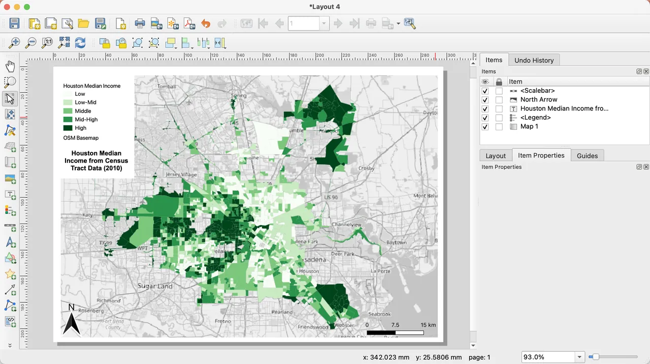
- Map making. Style layers, add labels, legends and scale bars, and lay out print-ready maps.
- Data formats. Works with shapefiles, GeoPackage, GeoTIFF, PostGIS, WMS/WFS and many other sources.
- Processing toolbox. Hundreds of vector and raster analysis tools, plus a graphical model designer.
- Editing. Digitize and edit vector features with snapping, attribute forms and undo.
- Plugins and Python. Extend QGIS with plugins from the official repository or PyQGIS scripts.
Who it is for
Good fit
GIS analysts, planners, researchers, students and NGOs who need professional mapping without license fees.
Look elsewhere
Casual users who just want to look at satellite imagery or plan a route; a globe viewer is simpler.
Pros and cons
Pros
- Free with no feature limits
- Reads and writes almost every geodata format
- Large plugin ecosystem
- Long Term Release for stable work
Cons
- Steep learning curve for GIS beginners
- Large installer and heavy on resources
- Interface can feel crowded
How to install QGIS
The direct link is the offline standalone MSI for the Long Term Release. It is a large download and does not include optional projection grids. If you want to keep QGIS updated or run several versions side by side, use the OSGeo4W network installer from the same page instead.
Questions about QGIS
Is QGIS free?
Yes. QGIS is open source under the GNU GPL and free for any use, including commercial work. Donations are welcome but optional.
Which QGIS version should I download?
The QGIS team recommends the Long Term Release (LTR) if you are unsure. The latest release has newer features but changes more often.
Can QGIS open ArcGIS files?
QGIS opens shapefiles and file geodatabases, and can read many other formats used with ArcGIS through GDAL.


